Wednesday, July 27, 2016

Days 107 - 121/July 17 to August 31

Miles hiked: Zero


Enjoying my two-week break at home with my wife. My right leg is healing well, so I plan to spend August 1st getting down to Waynesboro, VA. From there, I'll get shuttled up to Swift Run Gap and begin my hike south to Springer Mountain--some 906.8 miles away. 

In the meantime, I'm still working on a new backpack and some gear, all designed to reduce my load considerably. The fact that it will be hot and humid in the south, for the next couple of months allows me to carry less clothing, of course, but I'm also working to reduce my weight by leaving other things behind, like my poles and camp shoes.

Here's my current list of gear and clothing.  That's a substantial drop from the 22-25 pounds that I used before.


Saturday, July 16, 2016

Day 106/July 16

Miles hiked: 5.20 miles in 2:46

Start: Katahdin Stream Campground, ME

Finish: Mt. Katahdin, Baxter State Park, ME

Elevation gain: 4,213'


Only views came fairly low on the mountain. Clouds covered the higher elevations.


Frank Boscoe finishing the rock scrambling section.


Obligatory finish photo next to the new sign erected this year. 

Now I head home to spend at least a couple of weeks with Colette and to let my poor legs recuperate.

Route from my Suunto.


Friday, July 15, 2016

Day 105/July 15

Miles hiked: Zero

A day off in Millinocket, resting up before Frank and I climb Katahdin tomorrow.

The Appalachin Trail Lodge folks also own a cafe in town, with great food and plenty of trinkets to buy as well:


That's just a small sampling of what one could buy. :-)

And above the AT Cafe is the Trail Connection, where one can buy more stuff, or some specialty drinks. Plus, they have two computers that we can use, too. That's how I am updating the blog.

And on the wall is this great painting of the an aerial view of the trails around Katahdin:


Day 104/July 14

Miles hiked: 9.90 miles in 3:56

Start: Abol Bridge, ME

Finish: Katahdin Stream Campground, Baxter State Park, ME

Elevation gain: 827'


The final section before climbing Katahdin. This takes the thru hiker to a sign-up station for a spot to camp at The Birches, two shelters set aside only for through hikers to use. But only 12 people can be there on any one night. My hiking buddy, PA Farmboy was worried that he might not get a space, so we left early and he was the first one to sign up for a spot at the Birches. Mission accomplished.


PA Farmboy after soaking his bandana in the Nesowadnehunk Stream.


Looking a bit further downstream from the same spot. We would later see some thru hiker fly fishing on the stream--probably getting dinner.

When we got to Katahdin Stream Campground, PA Farmboy decided to go for the summit, while I opted to hitchhike into Millinocket, where I would stay at the AT Lodge, to wait a day for Frank Boscoe to join me so that we can climb Katahdin together.

And in downtown Millinocket, here is the million dollar restaurant that the paper mill build as a tourist attraction, just before they shut down the mill! As you can see, it's now for sale.


Route from my Suunto.

Day 103/July 13

Miles hiked: 15 miles in 8:40

Start: Rainbow Stream Lean-to, ME

Finish: Abol Bridge, west branch of Penobscot River, ME

Elevation gain: 1,526'


While not the day with the least amount of climb, this was probably one of the easiest stretches to hike--pleasantly flat, scenic and often pine needle covered trails.


Getting closer and closer.


Yes, the first 'ripe' blueberries that I saw on the AT. However, while looking ripe, they weren't at peak sugar level yet, so they weren't that tasty. This was on the top of Rainbow Ledges, just above treeline with a lot of open rock areas, so it gets more sun than most areas.


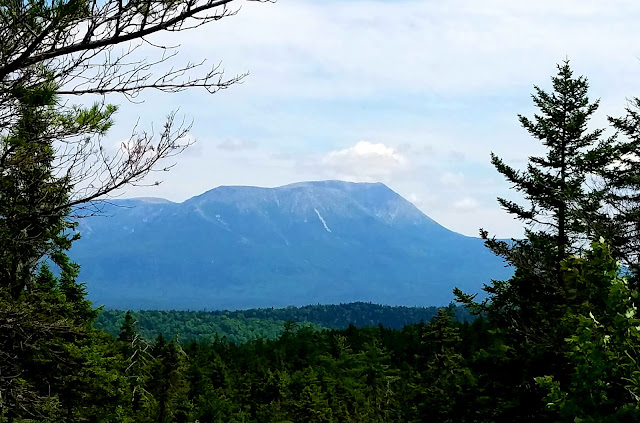
Now we are getting close enough to make Katahdin look like a big mountain, which it is. :-)


I'm now out of the 100-mile wilderness. This is what the SoBo hikers see as they enter it.


View from Abol Bridge. We stayed at the Abol Bridge Campground for the evening, just to the right in this photo.

Route from my Suunto.

Day 102/July 12

Miles hiked: 15.60 miles in 8:20

Start: Mahar Tote Road, mile 2,143.4, ME

Finish: Rainbow Stream Lean-to, ME

Elevation gain: 2,283'


Originally, I was going to take four days to do the final 40.5 miles to Katahdin Stream Campground, but my hiking buddy, PA Farmboy, was shooting for three days. Today, I decided to press it and do more miles than needed, which would mean an extra day of rest before climbing Katahdin.


Yes, there are some 'sandy' beaches along the lakes.


Katahdin in the distance.


View of Katahdin from the top of Nesuntabunt Mountain.


One of the many waterfalls/sluices that I saw as I neared the Rainbow Stream Lean-to. 

Route from my Suunto.

Day 101/July 11

Miles hiked: 14.00 miles in 6:37

Start: Cooper Brook Falls Lean-to, ME

Finish: Mahar Tote Road, mile 2143.4, ME

Elevation gain: 738'


A very nice, gentle section of the AT. Game plan was to stay at the White House Lodge, the only hostel in the 100-mile wilderness.


The early morning sun-dappled foliage was a welcome sight after yesterday's rain in the late afternoon.


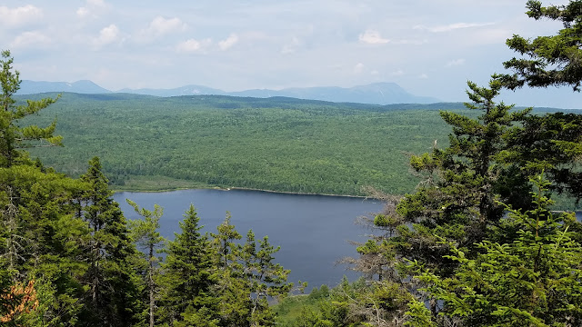
Just another beautiful Maine lake. They are always a welcome sight.


To get to the White House Landing, you have to call them to fetch you from the opposite shore of Pemadumcook Lake.


The short ride in the boat to the hostel was breezy and cool. On the left is PA Farmboy, who I got to hike with for a lot of the 100-mile wilderness.

Route from my Suunto.

Thursday, July 14, 2016

Day 100/July 10

Miles hiked: 17.10 miles in 9:25

Start: Sidney Tappan Campsite, ME

Finish: Cooper Brook Falls Lean-to, ME

Elevation gain: 3,091'


The last big mountain in the 100-mile wilderness, White Cap, at 3,650', came today. Alas, it was overcast and there were no great views. Only some summit signs could be photographed.


And the top of White Cap was above treeline and quite chilly. Got off of that in due haste.

The next 60 miles should be considerably less hilly, and net downhill.

Route from my Suunto.

Day 99/July 9

Miles hiked: 11.70 in 7:21

Start: Chairback Gap Lean-to, ME

Finish: Sidney Tappan Campsite, ME

Elevation gain: 2,835'


Another overcast, dreary day with few photo ops, the best coming when I stopped to pee:

But there was a pleasant surprise later when I set up my tent in the rain--there was a group of 14-16-year-olds from a camp that pulled in just after I did. The air was immedistely filled with giggles an lots of laughter as they set up their tents and a tarp.

Two of them came over to apologize for the noise, which I assured them was not bothering me at all--just as long as they would fall asleep at some time.

And then they invited me to join them for dinner later, as they had way too much pasta for them to eat. Pasta? How could I refuse.

In a little while, Giggles, a thru hiker would join the dinner, too.

The camp girls are doing a 300-mile section hike and get resupplied at just about all road crossings, even in the 100-mile wilderness.

They seemed to be having a blast. The two adult guides were called Good Mom and Worst Mom, although they were both friendly and kind souls in my opinion.

Route from my Suunto.

Day 98/July 8

Miles hiked: 10.70 in 7:50

Start: Trail to Otter Pond, mile 2089.9, ME

Finish: Chairback Gap Lean-to, ME

Elevation gain: 2,677'


Now into the hilly portion of the 100-Mile Wilderness. The thre major mountains to climb today were Barren, Fourth and Columbus Mountains, with some lesser ones, too.

While not as high as others, these were not easy ascents and descents since there were a lot of roots and rocks to deal with.


Rare insect-eating plant found in a planked bog.


Route from my Suunto.

Thursday, July 7, 2016

Day 97/July 7

Miles hiked: 15.30 in 7:12

Start: Mile 2089.9, junction of trail to Otter Pond, ME

Finish: Route 15, Monson, ME

Elevation gain: 3,455'


A day of slack packing while I waited for my new shoes to arrive. Poet, one of the owners of Shaw's Hostel, shuttled me to a trail that would join with the AT after a 0.8-mile climb. Then I turned left and headed south to Monson.


It was raining lightly when I started, and after some climbing, it was obvious that the hills were cloud covered.


The sun never made an appearance, but it wasn't too cold despite the rain.

Route from my Suunto.


And anothet pair of adidas Terrex X-Kings is being retired after 500 miles; these were worked over well by the rocks of the White Mountains and southern Maine. Still, the shoes remained intact, proving how tough they are.

Wednesday, July 6, 2016

Day 96/July 6

Miles hiked: Zero


Another day in Monson waiting for FedEx to deliver my new adidas Terrex X-Kings. Now they say delivery will be tomorrow by 4:30 p.m.

I can't wait that long, so I will get a shuttle into the 100-mile wilderness and hike back to Route 15 in Monson, where hopefully my shoes will be waiting for me.

In the meantime, I am fully carbo-, protein-, fat-, and calcium-loaded. ☺


I should try dying my hair that color. Oh, wait.


Tuesday, July 5, 2016

Day 95/July 5

Miles hiked: Zero


A day of rest while I wait for a new pair of adidas Terrex X-Kings to arrive.

Ever since summitting Mt. Washington, where I injured my right leg when a strong gust almost knocked me down, I have had some serious sciatica pain, which either limits my speed, or the amount of miles that I can hike in a day.

A day ago, it was so bad that I contemplated having to abandon the hike, or postone it for quite a while. But with just over 100 miles to Katahdin, it's hard to accept stopping at this point, so I am opting to do a lot of periformis stretching in the hope that It will help. I actually found a new stretch and while painful, seems to be helping.

In the mean time, I am in beautiful, scenic Monson. At least I can eat all I want; and there is an ice cream shop/bakery nearby. There is also a decent restaurant that will be open tonight, unlike on the 4th of July, when they closed.

Or like this place:


On the other hand, I have nothing but good words for the breakfast at Shaw's Hiker Hostel this morning. Scrambled eggs, homefries and blueberry pancakes. And Poet even serves up a Pancake Cairn:


Monday, July 4, 2016

Day 94/July 4

Miles hiked: 8.30 in 3:50

Start: Stealth tentsite, mile 2066.3, ME

Finish: Route 15, Monson, ME

Elevation gain: 1,391'


I think Katahdin is somewhere in there.


Route from my Suunto.

Day 93/July 3

Miles hiked: 13.70 in 8:43

Start: Bald Mountain Brook Lean-to, ME

Finish: Stealth tentsite, mile 2066.3, ME

Elevation gain: 2,602'


My not-so-stealthy tent site for the evening.


Route from my Suunto.

Day 92/July 2

Miles hiked: 14.70 in 8:09

Start: US Route 201, Caratunk, ME

Finish: Bald Mountain Brook Lean-to, ME

Elevation gain: 3,268'


Route from my Suunto.

Friday, July 1, 2016

Day 91/July 1

Miles hiked: 4.00 in 2:04

Start: Pierce Pond Shelter, ME

Finish: US Route 201, Caratunk, ME

Elevation gain: 180'


Small waterfall along Pierce Stream.


The canoe ferry on the Kennebec River, bringing some Sobos across.


Crossing the Kennebec, the safe way, with Rabbit helping with the rowing.


Route from my Suunto.