Tuesday, June 7, 2016

Day 65/June 5

Miles hiked: 12.24 in 5:47

Start: Moose Mountain Shelter, NH

Finish: Smarts Mountain Fire Warden's Cabin, NH

Elevation gain: 4,291'


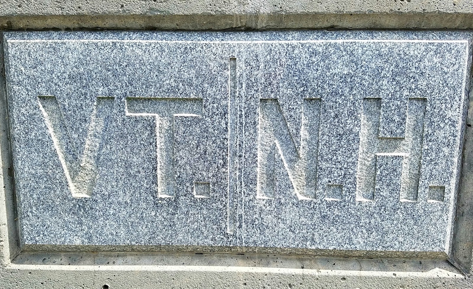
Really nicely engraved marker showing the distance to Mt. Katahdin. Not sure why they chose that location though--middle of nowhere.


Lots of wet rock faces to climb in New Hampshire--beautiful stone though.

Route from my Suunto.

Day 64/June 4

Miles hiked: 12.19 in 6:42

Start: Norwich, NH

Finish: Moose Mountain Shelter, NH

Elevation gain: 2,838


Another state done. The first 20 miles on the AT after it diverges from the Long Trail are surprisingly rugged.


Route from my Suunto.

Friday, June 3, 2016

Day 63/June 3

Miles hiked: 18.40 in 8:05

Started: unofficial tent site, mile 1728.4

Finish: downtown Norwich, VT

Elevation gain: 4,052'


Funny how I knew that I did not want to walk 20+ miles into Hanover, New Hampshire, but 18.4 into Norwich would be OK.

When I got to Norwich, I went to the library, where they had a list of "trail angels", people in the Norwich/Hanover area who will put up a thru hiker for a day to four days. And the best part is that there is no cost. Yes, these are wonderful folks. They have been doing this for twelve years. I only learned about them the day before.


Early-morning mist envelopes the nearby hills.

Route from my Suunto.


Day 62/June 2

Miles hiked: 18.05 in 8:45
Start: Stony Brook Shelter, VT
Finish: unofficial tentsite, mile 1728.4 on the AT
Elevation gain: 5,039'


I realize that I would rather be out hiking and finding beauty in nature any day, rather than sitting at home watching TV. These birches were gorgeous.


Vermont doesn't have a lot of thru hikers yet; most are section hikers, like this Boxer, Sydney.


No, I really didn't need this junk food, but another section hiker mentioned the place to me and it was only 0.2 miles off the trail.


I just love walking through hay fields.


Found at the edge of the hay field.

Route from my Suunto.

Day 61/June 1

Miles hiked: 16.64 in 6:48
Start: Route 140, Wallingford, VT
Finish: Stony Brook Shelter, VT
Elevation gain: 3,953

Bruce Shenker was awesome today--not only did he drive me to Vermont, he even suggested that I could slack pack a six-mile section that I had skipped, but he hiked in and met me for three sections.

That saved my butt, since it is so much easier to hike with a lightweight pack.


Bruce descending to the suspenion bridge near Route 103


View of Killington from just north of Route 4.


After ten miles of hiking, I suggested that since we had a car, lunch might be nice. We drove to Pittsfield, Vermont and had lunch at the general store. Quite good, too.


These fungi caught my eye due to their unusual bowl-like shape. Some guy who came along as I was taking the photo asked if I knew what they were. Of course I didn't. Then he pointed out that unlike most fungi, this variety had no gills. And, he said they were very tough--he could not rip one apart.

Route 1 from my Suunto.
Route 2.
Route 3.

Day 60/May 31

Miles hiked: zero

I worked out a deal with Frank Boscoe--he gets to use my Audi for a month and a half, but he has to drive to Katahdin, if I get there

I am pleased, since I won't have to worry about a ride home, and I think Frank is happy since there are three drivers at home, but only one car to share.

Day 59/May 30

Miles hiked: zero

Another day spent getting my gear in order.