Wednesday, June 29, 2016

Day 89/June 29

Miles hiked: 16.70 in 8:58

Start: East Flagstaff Road, New Portland, ME

Finish: Route 27, Stratton, ME

Elevation gain: 5,278'


Early morning clouds sitting on the peaks.


The things you really see when you stop to pee.


Enough info for you?


Horn Pond.

Route from my Suunto.

Tuesday, June 28, 2016

Day 88/June 28

Miles hiked: 8.3 in 4:12

Start: Caribou Pond Road, Stratton, ME

Finish: Route 27, Stratton, ME

Elevation gain: 2,441'


A short slack packing hike up Crocker Mountain and down to Route 27. I am glad that I have done a fair amount of slack acking recently--my leg seems to be healing well as I have had a couple of hikes with minimal pain. I will do one more slack pack, over the Bigelows, the last tough ridge in Maine, other than Katahdin.


Tomorrow's challenge--the Bigelows.


View of Sugarloaf Mountain.


My constant companions.


Not a lot of overlooks today--a nice view of the clouds brushing the high peaks.


Route from my Suunto.

Monday, June 27, 2016

Day 87/June 27

Miles hiked: 9.40

Start: Woods road, mile 1983.20, ME

Finish: Caribou Pond Road, Stratton, ME

Elevation gain: 2,815'


Route from my Suunto.

Day 85/June 25

Miles hiked: 13.20

Start: Route 4, Rangeley, ME

Finish: Route 17, Oquossoc, ME

Elevation gain: 2,874'


Route from my Suunto.

Day 86/June 26

Miles hiked: 14.50

Start: Woods road, mile 1983.20, ME

Finish: Route 4, Rangeley, ME

Elevation gain: 4,360'


Route from my Suunto.

Day 84/June 24

Miles hiked: 13.30 

Start: Route 17, Oquossoc, ME

Finish: South Arm Road, Andover, ME

Elevation gain: 3,796'


 View from Old Blue Mountain looking south to South Arm Road.

Day 83/June 23

Miles hiked: 4.50 

Start: Frye Notch Lean-to, ME

Finish: East B Hill Road

Elevation gain: 3,281'


Quixote and Audubon lead the way.


Whenever you see a ridgeline to the north and east, you are sure to be climbing there soon.


Friday, June 24, 2016

Day 82/June 22

Miles hiked: 4.30 in 2:09

Start: Frye Notch Shelter, ME

Finish: East B Hill Road, Andover, ME

Elevation gain: 978'

A very short hike in order to get to The Cabin, a hostel in East Andover. As I was hiking out, I met Rocket Man and One Step, who were slack packing SoBo, and they were excited to tell me that The Cabin was serving lobster and steak for dinner tonight.

Fortunately, I, too, already had a reservation, but didn't know that the hostel served dinner.

Since I was still congested and my right leg was killing me, I was glad to hear that dinner was no problem. Plus, I expected to start slack packing soon, too. I need to recover.


Wednesday, June 22, 2016

Day 81/June 21

Miles hiked: 9.90 in 8:36

Start: Speck Pond Shelter, ME

Finish: Frye Notch Lean-to, ME

Elevation gain: 3,822'


Day 80/June 20

Miles hiked: 8.58 in 7:53

Start: Carlo Col Shelter, ME

Finish: Speck Pond Shelter, ME

Elevation gain: 3,904'


Day 79/June 19

Miles hiked: 16.90 in 10:23

Start: White Mountains Hostel, Shelbourne, NH

Finish: Carlo Col Shelter, ME

Elevation gain: 6,670'


Saturday, June 18, 2016

Day 78/June 18

Miles hiked: 8.1 in 4:02

Started: Imp Shelter, NH

Finish: Route 2 and North Road, Shelburne, NH

Elevation gain: 328'


A long dowhill trek to the White Mountains Lodge & Hostel near Gorham.


Even the Whites can have the occassional nice trail.

Day 77/June 17

Miles hiked: 13.1 in 8:48

Started: Pinkham Notch, Route 16, NH

Finish: Imp Shelter, NH

Elevation gain: 6,010'


A tough day with lots of steep hills to climb, including the Wildcats and Carter Mountains. Our first view from one of the Wildcats.


A different look of the Presidentials, a dark outline.


A view from Imp Shelter to the west, rain storms in the distance.

Thursday, June 16, 2016

Day 76/June 16

Miles hiked: Zero


My right leg needs the day off, while the quad seems a lot better, the knee did not like walking down the stairs at the White Mountains Lodge & Hostel.

Went into Gorham and reviewed the upcoming sections in Maine; making a list of all the shelters and potential hostels to stay at when available.

And then to the Gorham Public Library to update the blog.

Day 75/June 15

Miles hiked: 15 miles in 9:55

Start: Lake of the Clouds Hut, NH

Finish: Pinkham Notch, Route 16, NH

Elevation gain: 4,806'


Finally the day to summit Mt. Washington was at hand. I skipped waiting for breakfast leftovers and just had a coffee and a Clif bar and headed out and up.

At the summit, the winds were brutal, although the sun was shining brightly. At one point on my descent, a very strong gust sent me flying and I struggled to get my right leg to break my fall. As it turned out, I strained my quad and hurt my knee, but didn't really notice it until much later in the day.


Yahoo! Only 332 miles to Katahdin.


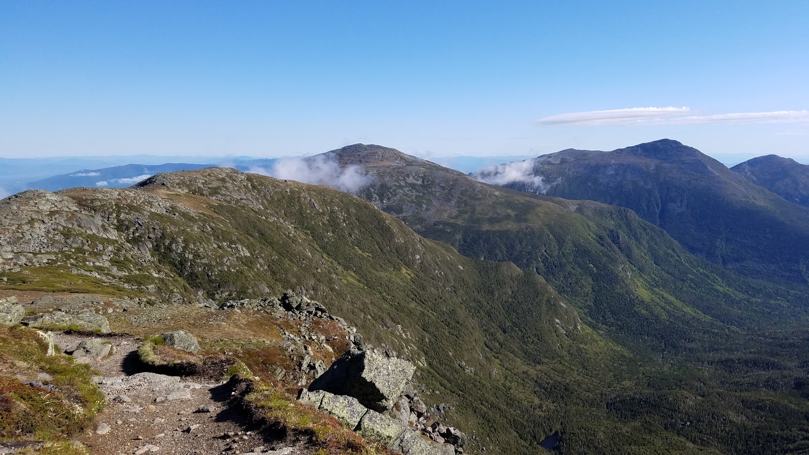
One Presidential mountain after another. Fortunately, the AT does not summit all of them.


Looking back at Mt. Washington from Madison; that's the toll road winding its way to the summit.

The descent off Madison showed me just how injured I was--I could barely use my right leg, and the Osgood Trail was just miserable--tons of above tree line rock scrambling and when it finally was below tree line, it was very steep.

At times I seriously wondered if I might have to stop and take a long rest. I managed to finish without stopping, but knew that tomorrow would have to be a Zero day, a bit of a bummer.

Route from my Suunto.